

The itinerary starts from the church of Norcen, where there are some parking spaces and an equipped area for pic-nic. From here you climb along the paved road, bordered by a fern-covered drywall. In about ten minutes you reach Valduna, a fraction with small groups of houses.
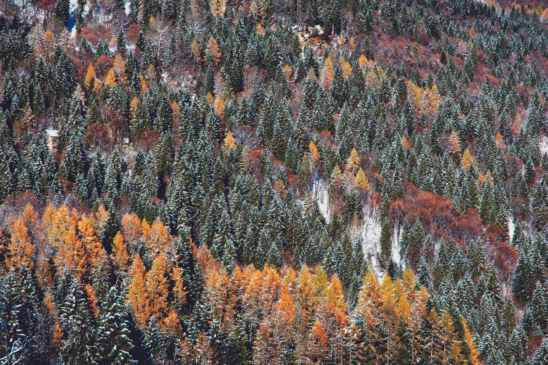
Continuing on the same direction, you go through a wood with fir, larch and hornbeam, until you notice, near the street, a construction that has typical elements: stone stairs to facilitate the entrance to the barn, and masonry with porphyry sides to give greater resistance to the corners.
After passing a valley, you walk until the crossroad of Case Valerna (about one hour from Norcen), where you abandon the paved road that goes up to the Paradis, to continue on a dirt road. Left some old buildings, the path leads in a few minutes to the source Boa and then to the locality of Stalle Boa. Along the main path, after about 100 m from the torrential incision of Porcilla, you follow on the right a mule track that goes through the woods between greenish-barked kernels, fir trees and willows.
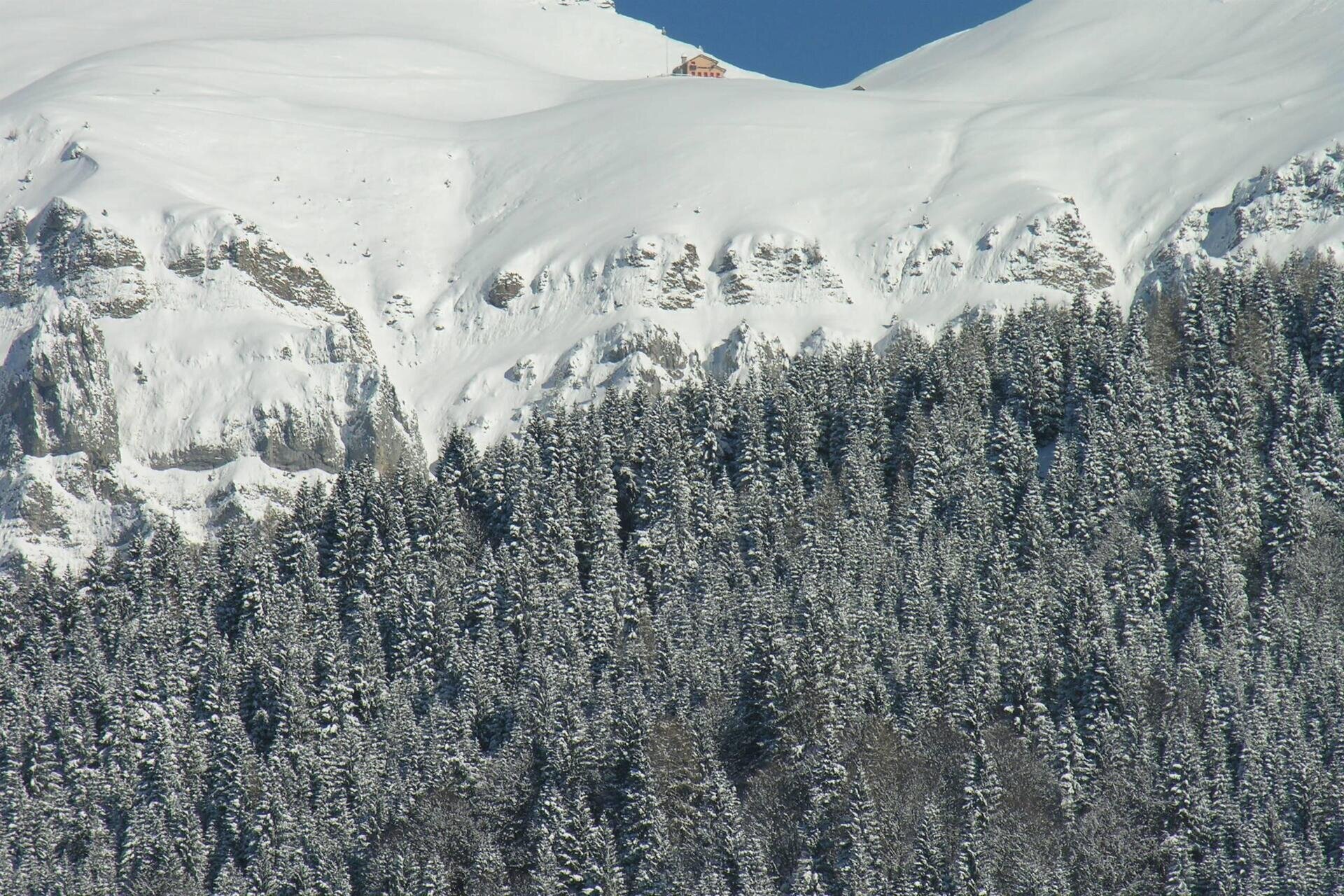
Near a watershed, leave the most evident track to go up the wooded slope to the left. Once you have gained the road coming from Pedavena, you follow it uphill and, immediately after a hairpin bend, you deviate on a secondary track. Reached the paved road again, you proceed in view of Croce d'Aune.
Arrived in Cimamonte (about three hours from Norcen), point of passage of the Alta Via n. 2 and the itinerary of "Chiesette Pedemontane", continue along the cart track on the right. After about half an hour's of walk from Croce d'Aune, you arrive at Stalle Norcenadego; towards south it can be seen the grassy hill of Soladen.
At the next crossroad, you continue on the right; however, you can make a pleasant digression, continuing straight until the view opens up on Mount Magheron and the lawn of Camogne.
Back on the route, you go downhill along a dirt road that, at the thaw and in periods of intense rainfall, can be muddy. The steep mule track, uneven due to the presence of coarse stones, leads you to a crossroad, from which you head to the right. The path continues downhill, reaching, after a few bends, the meadow where rise the beautiful casère in Paradis. From here turn left, descending along a valley covered with woods; past a rustic block, you will soon reach the clearing of Casera Fioretta.
Just below Casere Monegat, at a bend in the paved road, the path detaches and, in a few minutes, descends to an important crossroads. You proceed to the right, always immersed in the forest of beech and spruce; a little further downstream you meet a mule track, which runs to a clearing where there are large erratic boulders. At the crossroads in Trugno, follow the paved road downhill, which runs along a small valley, to lead to Norcen and then to the starting point.
FURTHER INFORMATION ON… Dolomiti Bellunesi National Park
The Dolomiti Bellunesi National Park extends for about 32.000 hectares, interests 15 municipalities in the province of Belluno, including Pedavena. The current perimeter derives from an initial core of nature reserves that were instituted in the 70s in order to protect the high altitude environments, the richest in flowers and wildlife, and also the most vulnerable. The official birth dates back to 1993, year in which the authority of the National Park was instituted. Now the territory includes the upper part of the mountain groups such as the "Alpi Feltrine", the “Monti del Sole”, the “Schiara-Talvena” and the “Prampèr”, and it descends into the valleys excluding the inhabited centers. Walking through the park, can be seen very different environments: water routes, woods, shrubs, alpine grasslands, scree and rocky walls. The high biodiversity is one of its characteristics: 1500 botanical species, of which many rare or endemic, 4 species of Tetraonids (capercaillie, black grouse, hazel grouse and partridge) and Ungulates (roe deer, deer, chamois and mouflon).
USEFUL INFORMATION
Start and finish: Church of Norcen (510 m. a.s.l.)
Places crossed: Valduna, Valerna, Stalle Boa, Croce d’Aune, Cimamonte, Stalle Camogne, Pian dell’Albero, Paradis, Salzena, Monegat, Grip, Trugno
Signage: blue and white directional arrows with the words “Anello delle Camogne”
Lenght: 11,4 km
Elevation gain: 586 m
Travel time: h 5.00
Difficulty: medium
Recommended period: accessible all year round, but particularly enjoyable in fall for the colors of the vegetation; in winter, it can become challenging due to the presence of snow and possible icy sections.
Points of interest: village and church of Norcen, village of Croce d’Aune, landscape of the Camogne and of Salzena, typical rural buildings.
Note: this is a rather long itinerary with a considerable elevation gain that leads to Croce d'Aune. However, the route does not present any particular difficulties, except for some steep sections, occasional muddy patches, and uneven terrain. Therefore, it is suitable for experienced mountain bikers as well.
You are in a natural environment that requires respect:
- Prohibition of collecting flowers
- Prohibition of bathing
- No to the shouting
- Prohibition of ignition of fires
- Do not leave waste around, but throw them in the appropriate spaces (also cigarette butts, tissues, masks and wet waste)
- Minors must be accompanied
- Dogs must be kept on a leash and their collected excreta
- Do not leave the path
- Do not disturb the local fauna
It is suggested to inquire through the ARPAV website about any disturbances before embarking on the route.

