

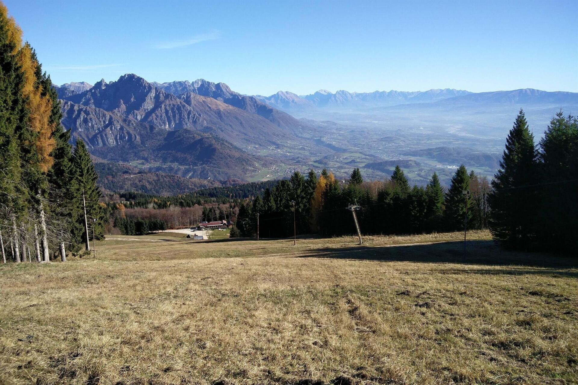
The ring of the alpine pastures of Monte Avena is an easy walk that allows you to enjoy a truly praiseworthy panorama to the north over the Vette Feltrine, with Monte Pavione being the highest peak, while to the south you can see the Massiccio del Monte Grappa, with the prominent ridges of Fontana Secca, Solaroli, Col dell’Orso, Cima Grappa, Monte Tomatico, and just below the Lago del Corlo. There is also a small view to the east towards the Lagorai with Cima d'Asta and to the west over the Altopiano di Asiago with Cima XII. A truly 360-degree panorama!
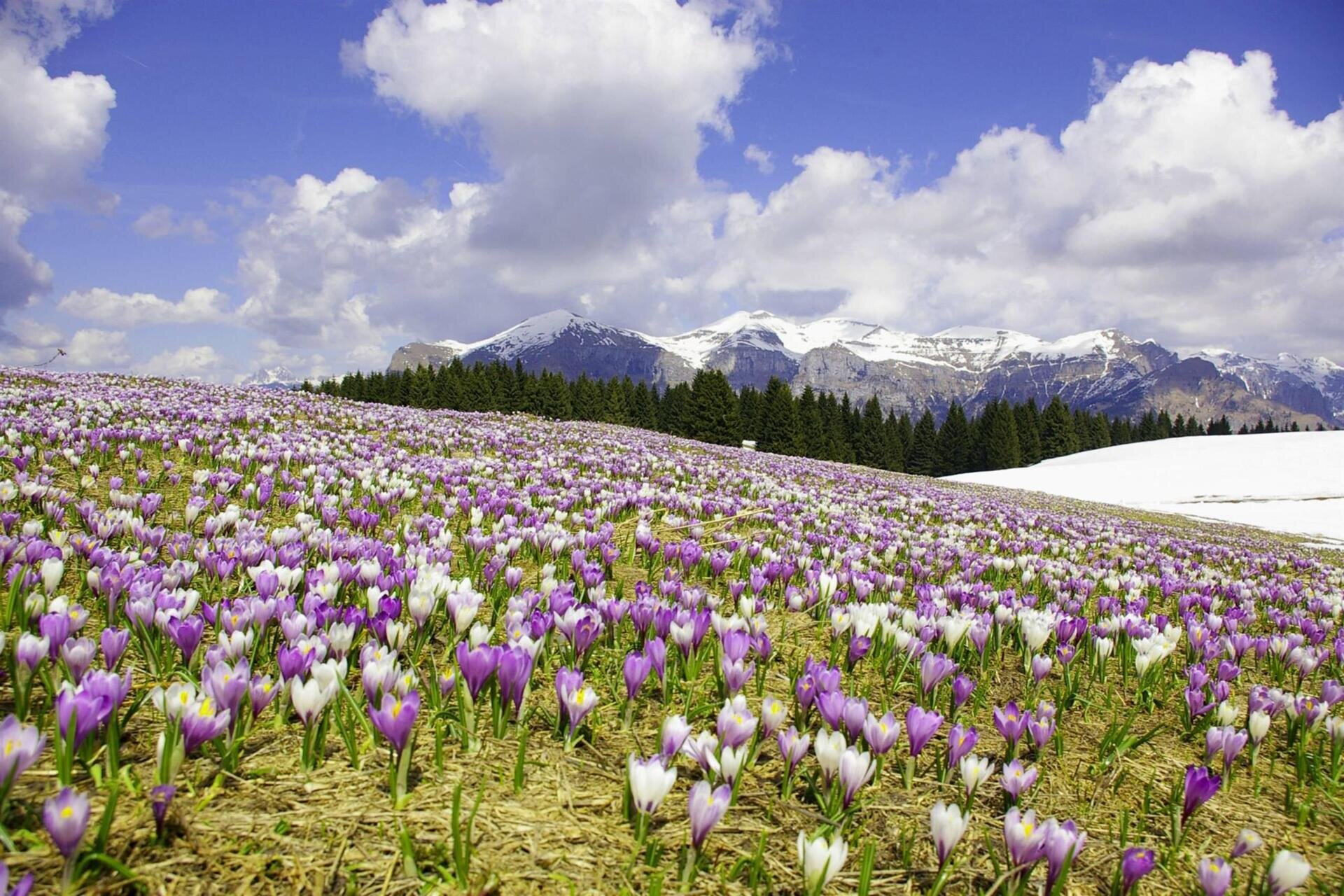
In spring, it is the ideal environment to admire the blossoming of Crocuses, which, blooming as the snow melts, fill all the mountain pastures, creating a unique landscape.
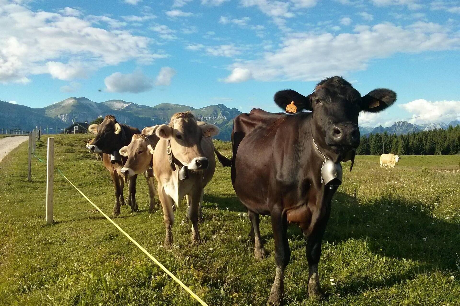
In summer, it is possible to stop at the alpine huts along the route: Malga Campet and Malga Campon. From the latter, you can reach the Croce d’Avena, which overlooks the Lago del Corlo from above.
For lovers of paragliding, Monte Avena is also referred to as the “sky of champions” as it is a famous take-off spot for those who love this sport and a location where the Italian Paragliding Championships are held.
You start on foot from the Casere dei Boschi location, situated approximately halfway along the gentle ridge connecting the Passo di Croce d’Aune to the peak of Monte Avena. Here, there is an alpine hut owned by the Municipality of Pedavena, included in the perimeter of the Dolomiti Bellunesi National Park. There is also a large parking area and a picnic area.
After taking the dirt road uphill from the hut, you immediately turn right onto the grassy slope. You then climb up the meadow, which at the beginning of spring is dotted with white and purple crocuses, gradually gaining a panoramic position over the Vette Feltrine. You proceed pleasantly, distracted by the sounds of birds that populate the forest and the tracks left by other animals. In winter, hare prints are common in the snow, and as soon as it melts, networks of tunnels built by voles emerge. Higher up, you can observe somewhat stunted and twisted beech trees, probably a result of livestock grazing.
After about half an hour of walking, the slope decreases near the porphyry milestone marking the boundary between the municipalities of Pedavena and Fonzaso. Soon you reach the summit plateau of Monte Avena, and the view opens wide over the Vette, the Lagorai chain, the Cima d'Asta mountain group, the Asiago plateau, and the Grappa massif (from north to south). Following the path first on meadow and then on a dirt road, you can reach Malga Campon and, turning left before the hut, the Croce d’Avena, overlooking the steep side that dominates the plain of Fonzaso. Between March and October, the pasture fills with scents and colors when buttercups, bellflowers, gentians, orchids, and the less conspicuous grasses bloom.
Returning along your path to near the top station of the ski lift, you walk down the road that gently descends toward Casere dei Boschi. The walk is very pleasant due to the panorama you enjoy from up here, and if conditions are favorable, you can see the colorful paragliders and hang gliders soaring. The take-off runway of Monte Avena is internationally known and periodically hosts important free flight competitions.
Just over a kilometer down, passing under the ski lift, you come to a crossroads; continuing along the main path, you can descend directly to Casere dei Boschi in about 30 minutes. The itinerary, however, continues downhill along the ridge, avoiding the comfortable mule track on the right; after crossing the red fir forest, with some patches of raspberry, you emerge onto a beautiful grassy clearing where the rustic buildings of Stalle Buse stand. Here, passing in front of the buildings, you can descend in a few minutes to the paved road, near the large parking area of the Chalet alle Buse, the starting point of the main ski slope of Monte Avena. We then follow the asphalt road to the left, which, on a slight ascent, passes some wooded valleys and the Albergo Sporting, allowing us to quickly return to the starting point.
INSIGHT ON... The archaeological site of Monte Avena
In the Pleistocene, the peak of Monte Avena emerged above the thick layer of ice that covered the Belluno valley. This caused the sediments that accumulated over the millennia on the summit and slopes to remain intact, allowing the preservation of the oldest human vestiges. Between 1984 and 1986, archaeologists from the University of Ferrara conducted a scientifically significant excavation in a small depression adjacent to the road leading to Malga Campon. Through deepening the layers, a few Middle Paleolithic (Mousterian) artifacts, produced by Neanderthal man around 60,000 years ago, were collected. However, numerous finds belonging to Upper Paleolithic culture (about 30,000 years ago) were found. In the higher levels of the excavation, tools made about 5,000 years ago by the last individuals of the Neolithic culture and the first users of copper were collected. Finally, in a depression of the Campon d’Avena, fragments of pottery dating back to the early Iron Age were identified: these are evidence of the presence of camps of breeders from the protohistoric period.
USEFUL INFORMATION:
Departure and arrival: Malga Casere dei Boschi (1253 m a.s.l.)
Locations crossed: Campon, Campet, Le Buse
Signage: white and blue directional arrows with the text “Anello del Monte Avena”
Path length: 6.1 km
Elevation gain: 239 m
Duration: 2.30 hours
Difficulty: medium
Recommended equipment: sports shoes
Recommended period: all year round; pleasant in summer for the flowering of the summit pastures and in autumn for the colors of the landscape; in winter it is very suggestive, but you need to pay attention to the possible presence of ice on the road surface and intersections with ski slopes and lifts.
Points of interest: landscape and archaeological site of M. Avena, launching point for paragliders and hang gliders, Malga Casere dei Boschi, Malga Campet, Malga Campon, panoramic viewpoint of Croce d’Avena.
Notes: A route of medium duration with a contained elevation gain, winding between Casere dei Boschi and the summit of Monte Avena; the trail presents no particular difficulties, except for some steep and sometimes muddy sections. It can also be traversed on mountain bike, with some experience and training.
You are in a natural environment that demands respect:
- Prohibition of flower picking
- Prohibition of swimming
- No noise
- Prohibition of lighting fires
- Do not leave waste around, but dispose of it in designated areas (including cigarette butts, tissues, masks, and organic waste)
- Minors must be accompanied
- Dogs must be kept on a leash and their waste collected
- Do not stray from the path
- Do not disturb local wildlife
It is recommended to check the website of ARPAV for any disturbances before undertaking the route.


